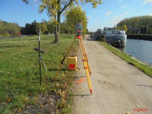
 As part of the sector 1 project studies between Compiègne and Passel, the SCSNE is going to start a new campaign aimed at carrying out topographic and bathymetric surveys (measurements of the depths and relief of the waterway).
The SCSNE entrusted the company INGEO with carrying out these surveys. This campaign, which will take place between September and December 2018, will consist of setting benchmarks for leveling and measuring the position and altitudes of structures, land and riverbeds. Information that will serve as references for construction companies.
These surveys will make it possible to carry out the detailed studies of the Seine-Nord Europe project prior to the constitution of the consultation files of the works companies.